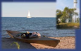
A water trail on the Wisconsin shoreline of Lake
Michigan and its tributaries is being developed. Once
completed the trail will enable sea kayakers and
canoeists to travel along the shores of Lake Michigan
and have campsites along the way to overnight at. The
Wisconsin trail will link-up with trails in Illinois and
Michigan.
I am coordinating the
development in Wisconsin. I have been “scouting” the
Lake Michigan shore by kayak, by car, and by “virtual”
paddling using mapping software on my computer.
 I am seeking
input from other sea kayakers to provide information
about their access points and camping sites, as well as
other lodging options, on Wisconsin’s Lake Michigan
shoreline and its tributaries. Wherever possible it is
desired to establish campsites at existing public lands
(state and county parks and forests). Where the
distance between sites is greater than one days paddle,
attempts will be made to establish sites on private land
through an agreement with the landowner. It is also
desirable to identify eating establishments and lodging
of the hotel/motel/bed-and-breakfast type that would be
accessible to users of the water trail. If you have a
possible water trail site, please complete the "site
survey form", and by using the
"submit" button the form will be emailed directly to me.
I am seeking
input from other sea kayakers to provide information
about their access points and camping sites, as well as
other lodging options, on Wisconsin’s Lake Michigan
shoreline and its tributaries. Wherever possible it is
desired to establish campsites at existing public lands
(state and county parks and forests). Where the
distance between sites is greater than one days paddle,
attempts will be made to establish sites on private land
through an agreement with the landowner. It is also
desirable to identify eating establishments and lodging
of the hotel/motel/bed-and-breakfast type that would be
accessible to users of the water trail. If you have a
possible water trail site, please complete the "site
survey form", and by using the
"submit" button the form will be emailed directly to me.
Most recently, I have
been working with the Wisconsin DNR to include water
accessible campsites in the master plan for Harrington
Beach State Park. A site has been approved by the
Natural Resources Board, and site selection is
underway. This site will be ready to use by June 2005!
Anyone having
information relevant to this development, or desiring to
work on the project, is encouraged to contact me via
e-mail at
seakayakerjb@aol.com.
For a listing of
potential points, and information concerning, click here
water trail points. This is
"work-in-progress". For a map of the north half of the
trail (Manitowoc County north) click here
water trail north segment.
For a map of the south half of the trail (Sheboygan
County south) click here
water trail south segment.
The plan is to eventually provide "hotspots" on the
maps, each having a hyperlink that will provide
detailed information about that area. For example, by
clicking on Port Washington, you would be forwarded to a
page providing details about where to launch and land
(at the marina), lodging (there's a Holiday Inn on the
harbor and a bed & breakfast nearby, the numerous eating
establishments, as well as other relevant information
for the water trail user. I could really use your input
to make this a valuable resource.
If you have
suggestions, please e-mail them to me at
seakayakerjb@aol.com or use
the "site
survey
form". The more
detailed your input, the better. Thanks!